Click the arrows at the bottom of your screen to visit each section.
1/3
Click the arrows at the bottom of your screen to visit each section.
Use the navigation bar/menu to revisit any part of the meeting.
Leave your feedback any time on our Comment Form.
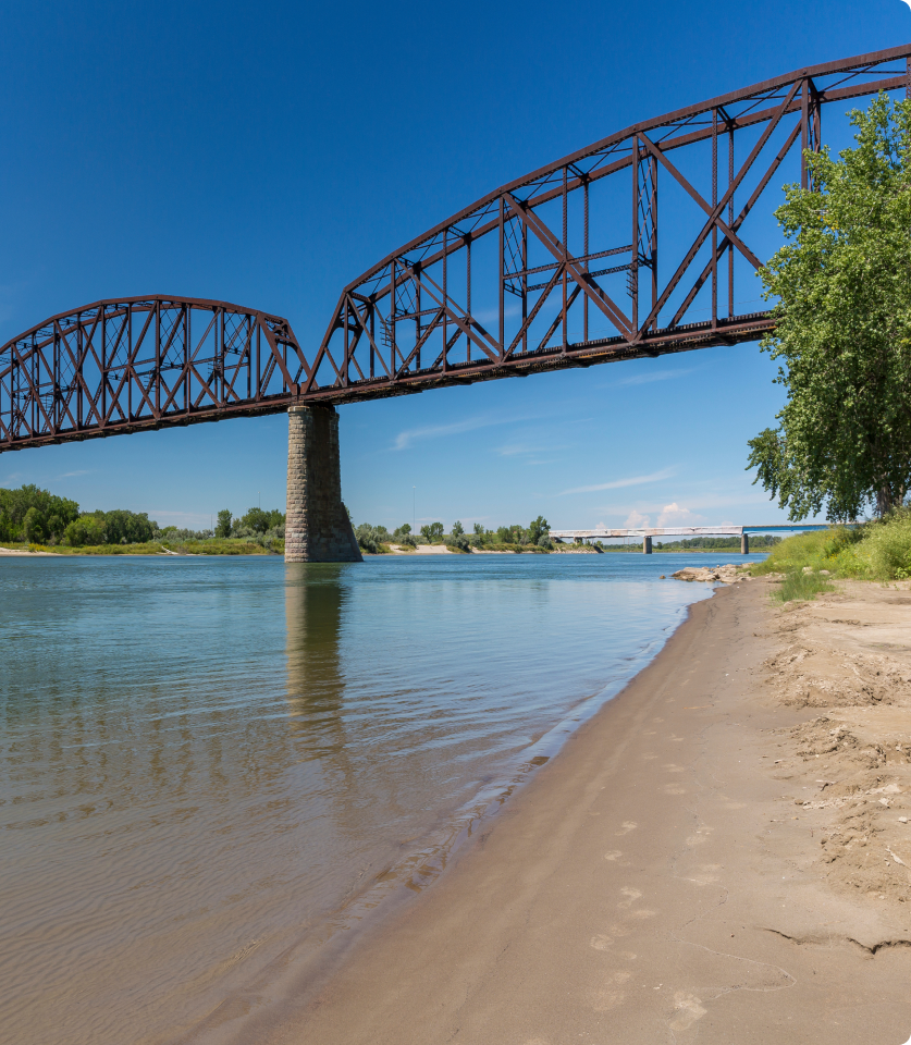
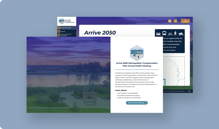
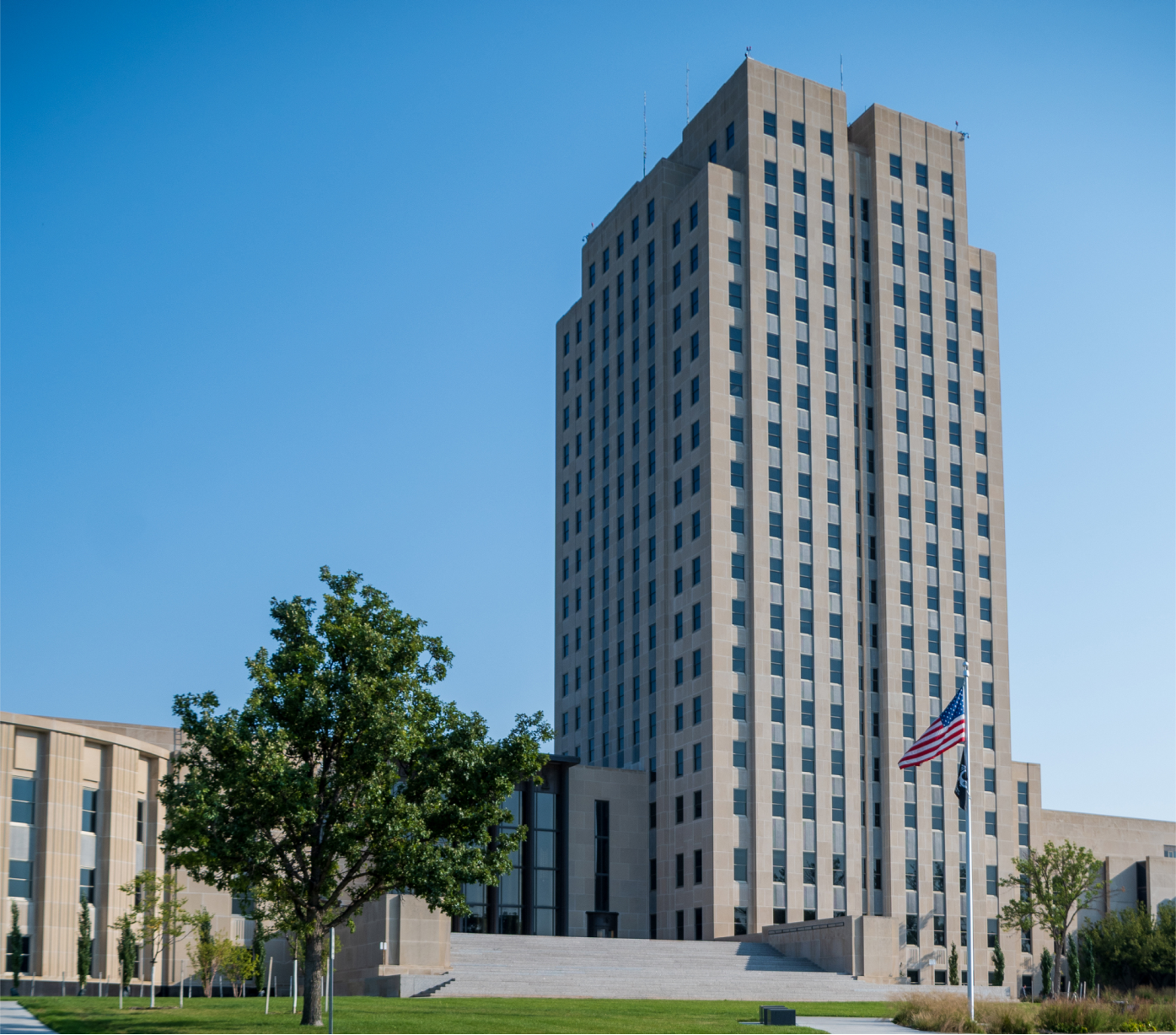
The Metropolitan Transportation Plan (MTP) guides the development of the Bismarck-Mandan area’s multimodal transportation system over the next 20+ years. The MTP is updated by the Bismarck-Mandan Metropolitan Planning Organization (MPO) once every five years. Regular updates allow for goals and needs to be reassessed in a timely manner.
The MTP is an opportunity for the area to consider how the multimodal transportation system could look and function in the future.
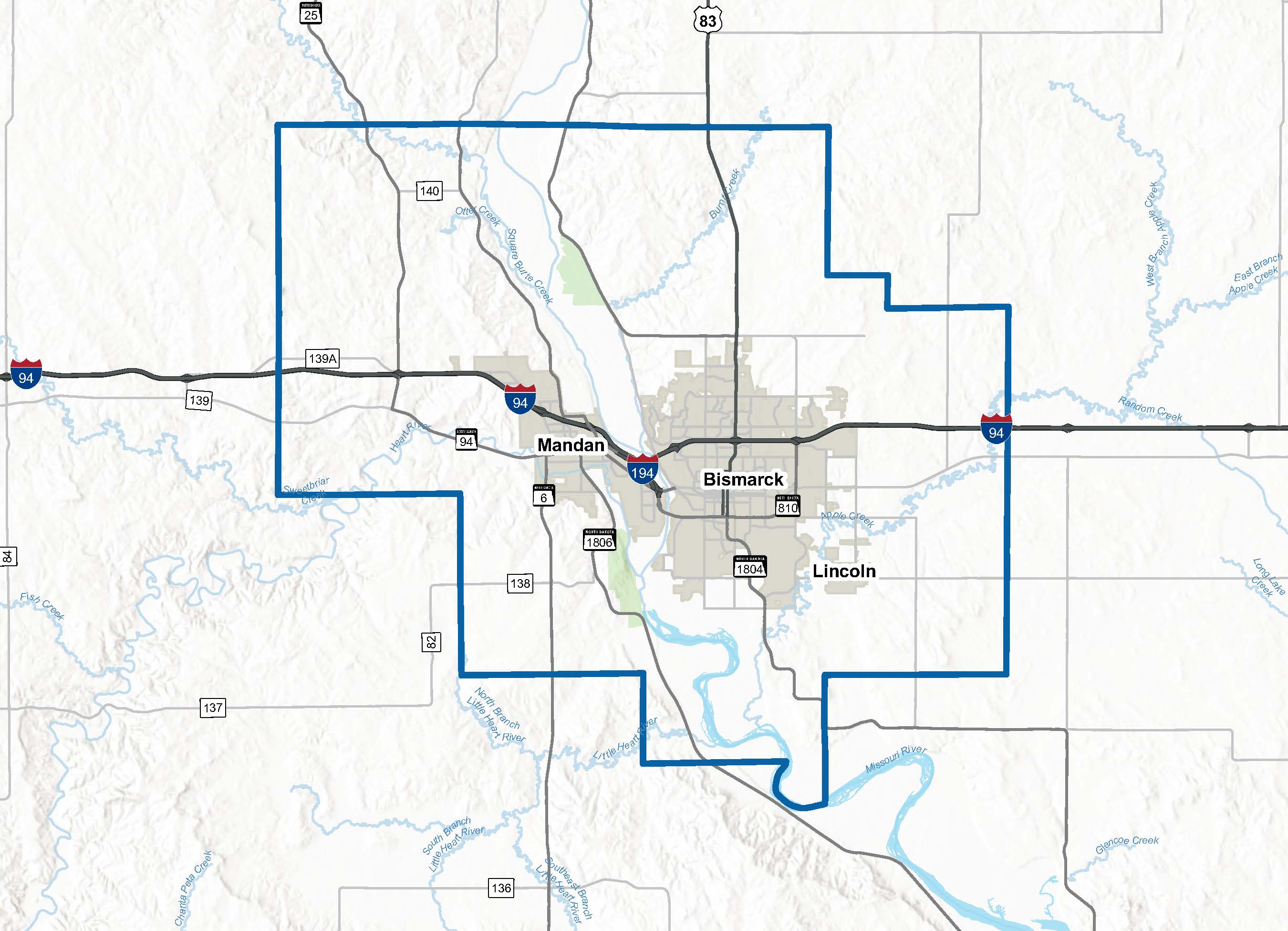
The project team relies on previous studies done for the area to determine the future needs and plans for the metro. Review some of the key studies used for Arrive 2050.
Completed in July 2019, the study identified viable highway alternatives along US Highway 83 north of Bismarck to best serve existing and future stakeholders within the region while also analyzing potential new routes for regional traffic.
Completed in December 2018, the purpose of the Bismarck-Mandan Regional Freight Study was to find the most used freight routes, detail the first and last mile of freight movement as well as freight movement through the region, and determine the need for investing in the local infrastructure to facilitate efficient and effective freight movement.
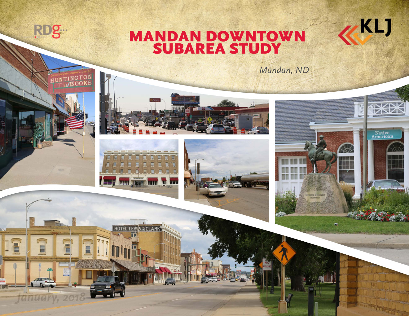
Completed in January 2018, the Mandan Downtown Subarea Study looked at future growth and needs for the Mandan downtown area.
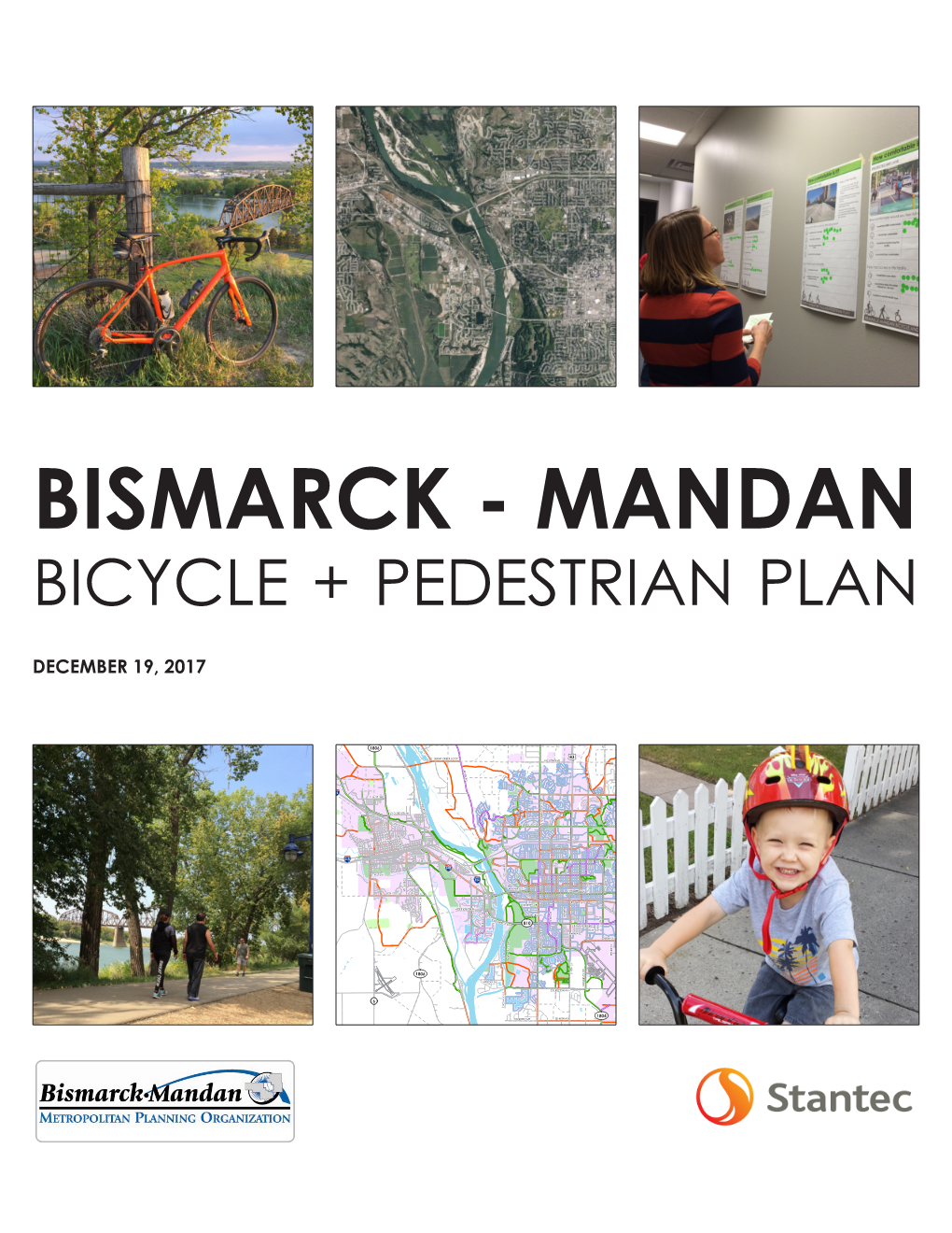
Completed in December 2017, this bicycle and pedestrian plan was created to support and grow engineering, education, encouragement, enforcement, and evaluation efforts to advance bicycling and walking as safe, comfortable, and reliable modes of transportation in Bismarck-Mandan.
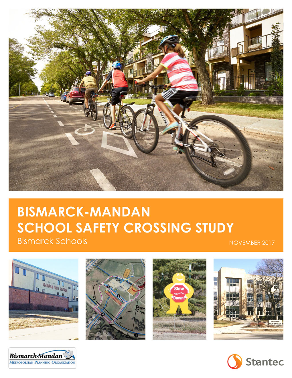
Completed in November 2017, both Mandan and Bismarck school districts partnered with the MPO and others to access the pedestrian and bike improvements needed to keep students safe while traveling to school.
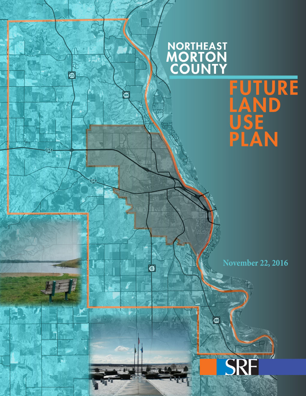
Completed in November 2016, the purpose of the future land use plan was to serve as the basis for the county’s zoning decisions. The land use plan provides a blueprint for implementing growth and land use goals and objectives to current citizens, property owners, prospective citizens, developers, and buyers.
Completed in August 2016, the Mandan-Bismarck Corridor Improvement Study looked at 20 corridors to improve traffic operations and reduce crashes along them.
Completed in April 2016, the Burleigh County Land Use Plan focused on the physical form of the planning area through 2040.
Completed in May 2023, this study documented existing conditions along East Main Avenue and identified strategies to ensure safety, mobility, and access for all future users in the area.
Completed in April 2023, this study addressed the expanding needs of Sunset Drive due to population growth and the aging infrastructure by planning alternatives to guide future development and redevelopment of the corridor to better serve the needs of all users.
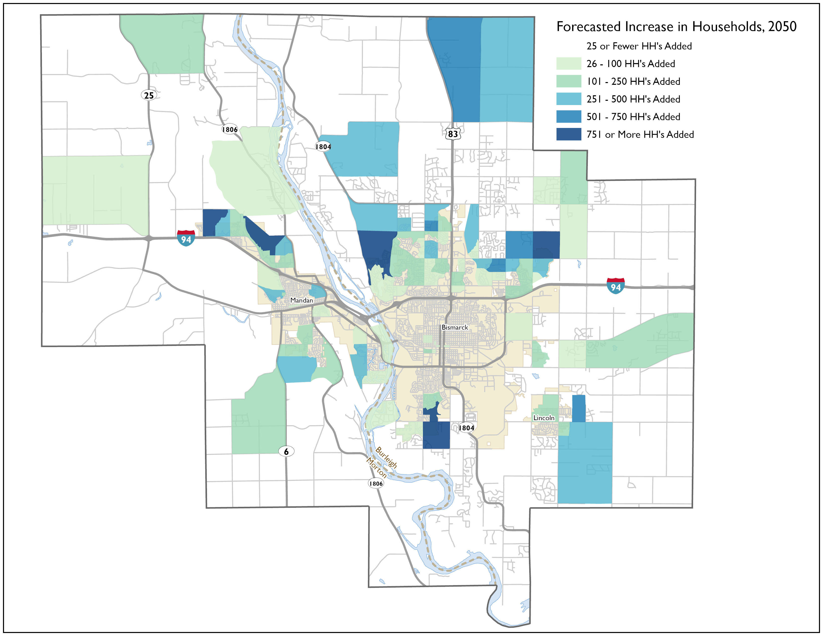
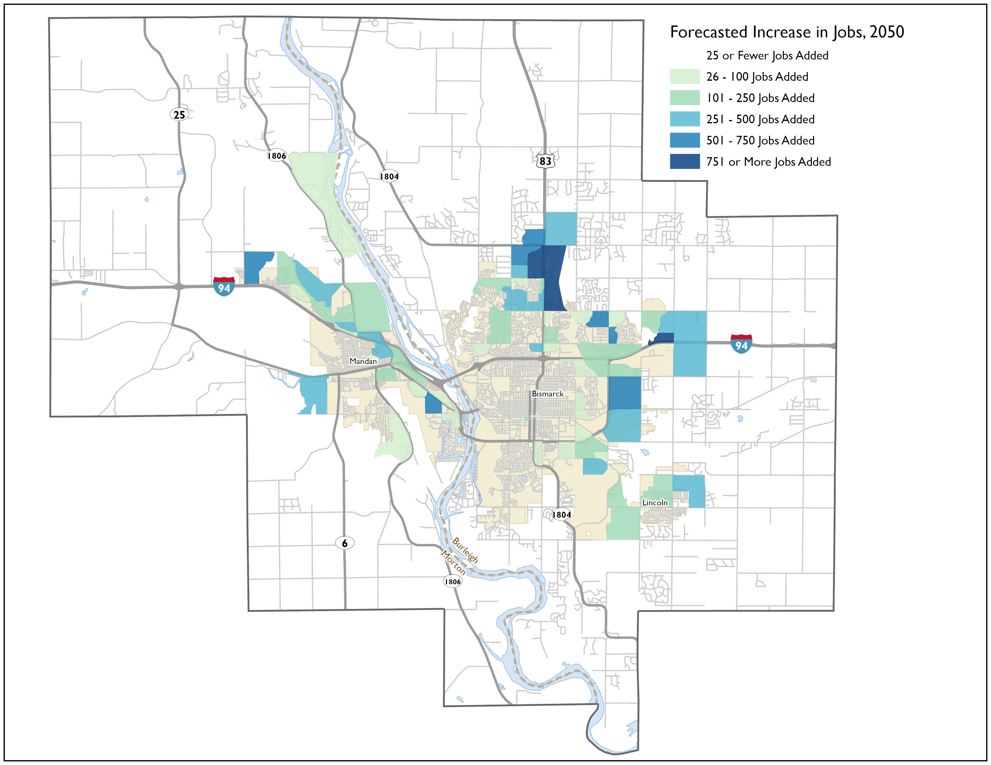
Forecasted employment and household growth for the Bismarck-Mandan Area is shown. The way a metro area grows greatly impacts the transportation demands of the area.
Shown is the estimated household growth for the next 25 years for the metro area.
Shown is the estimated employment growth for the next 25 years for the metro area.
Based on the public and stakeholder input and technical analysis of safety and mobility needs, a range of potential transportation project alternatives were developed. This list includes more projects than could fit within the MPO’s anticipated budget but were further considered in the plan.
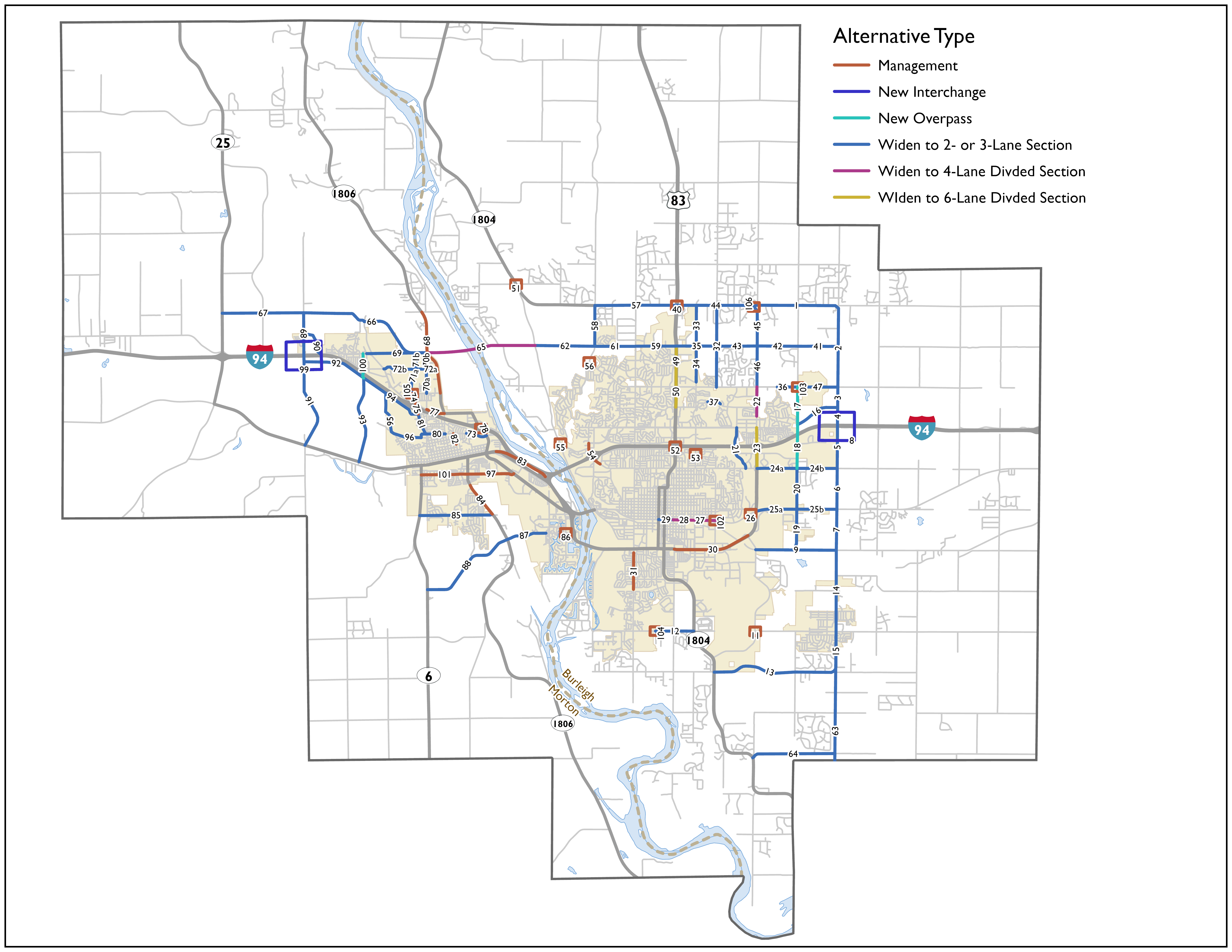
The numbers on the map above correspond to the table below.
| ID | Corridor Location | From | To | Description | 2024 Cost |
|---|---|---|---|---|---|
| 1 | 71st Avenue | Centennial Road | 66th Street | Reconstruct as a 3-lane rural section. | $18,744,000 |
| 2 | 66th Street | 43rd Avenue | 71st Avenue | Reconstruct/New Construct as a 3-lane urban section. | $27,690,000 |
| 3 | 66th Street | Century Avenue | 43rd Avenue | Construct as 3-lane urban section (tied with project for interchange with I-94 at 66th Street). | $6,816,000 |
| 4 | 66th Street | I-94 | Century Avenue | Construct as 3-lane urban section (tied with project for interchange with I-94 at 66th Street). | $6,390,000 |
| 5 | 66th Street | 17th Avenue | I-94 | Construct as 3-lane urban section (tied with project for interchange with I-94 at 66th Street). | $14,910,000 |
| 6 | 66th Street | Old Highway 10 / E Main Avenue | 17th Avenue | Construct as 3-lane urban section (tied with project for interchange with I-94 at 66th Street). | $14,200,000 |
| 7 | 66th Street | Apple Creek | Old Highway 10/ E Main Avenue | Widen from 2-lane to 3-section. | $14,948,000 |
| 8 | I-94 | 66th Street | New interchange. | $40,000,000 | |
| 9 | Apple Creek Road | Yegen Road | 66th Street SE | Widen to 3-lanes and intersection capacity improvements at Yegen Road. | $29,452,000 |
| 11 | Lincoln Road | Yegen Road / Airway Avenue | Intersection capacity improvement. | $5,925,000 | |
| 12 | Burleigh Avenue | High Plains Road | University Drive | Widen to 3-lane urban section, consider roundabout at 12th St intersection. | $15,612,000 |
| 13 | 48th Avenue S | University Drive | 66th Street | Construct 2-lane rural section and structure improvements at Apple Creek crossing. | $7,560,000 |
| 14 | 66th Street | Lincoln Road | Northgate Drive | Widen from 2-lane to 3-section. | $20,276,000 |
| 15 | 66th Street | 48th Avenue S | Lincoln Road | Reconstruct as 2-lane urban section. | $2,440,000 |
| 16 | Century Avenue | 52nd Street | 66th Street | Construct 3-lane urban section. | $16,046,000 |
| 17 | 52nd Street NE | 43rd Avenue NE | E Century Avenue | Widen from 2-lane to 3-lane section / build new 3-lane section. | $15,836,000 |
| 18 | 52nd Street NE | E Century Avenue | 17th Avenue NE | I-94 overpass and street improvements from Century Ave to Divide Ave. | $25,836,000 |
| 19 | 52nd Street | Apple Creek Road | 17th Avenue | Widen to 3-lane urban section, consider roundabout at Highway 10 / Main Street intersection. | $31,448,000 |
| 20 | 52nd Street | Main Avenue | 17th Avenue | Widen to 3-lane urban section. | $14,224,000 |
| 21 | Hamilton Street / Channel Drive | Divide Avenue | Century Avenue | Construct as 2-lane urban section with grade separation. | $28,770,000 |
| 22 | Centennial Road | Jericho Road | 43rd Avenue | Widen from 3-lane to 5-lane urban section. | $16,776,000 |
| 23 | Bismarck Expressway / Centennial Road | Divide Avenue | Century Avenue | Widen from 5-lane to 6-lane section. | $28,600,000 |
| 24a | Divide Avenue | Bismarck Expressway | 52nd Street | Construct as 3-lane urban section. | $14,800,000 |
| 24b | Divide Avenue | 52nd Street | 66th Street | Reconstruct 3-lane urban section. | $14,200,000 |
| 25a | Main Avenue | Bismarck Expressway | 52nd Street | Widen from 2-lane to 3-lane section (including intersection improvement at 52nd Street). | $15,400,000 |
| 25b | Main Avenue | 52nd Street | 66th Street | Widen from 2-lane to 3-lane section. | $15,400,000 |
| 26 | Main Avenue | Hay Creek Crossing | Structural replacement. | $685,000 | |
| 27 | East Main Avenue | Airport Road | 26th Street | Reconstruct as a 5-lane urban section. | $11,271,000 |
| 28 | East Main Avenue | 12th Street | Airport Road | Reconstruct as a 5-lane urban section. | $11,713,000 |
| 29 | East Main Avenue | 7th Street | 12th Street | Reconstruct as a 3-lane urban section. | $5,112,000 |
| 30 | Bismarck Expressway | 12th Street | Yegen Road | Implement 3/4 access control at 5 intersections and add right turn at Airport Road. | $1,185,000 |
| 31 | Washington Street | Drainage Channel | Denver Avenue | Turn lane improvements including restripe south of Reno Avenue as 3-lane section. | $924,300 |
| 32 | 26th Street | 43rd Avenue | 71st Avenue | Construct as 3-lane urban section. | $17,688,000 |
| 33 | N 19th Street | 57th Avenue NE | 71st Avenue | Reconstruct 3-lane urban section. | $14,200,000 |
| 34 | N 19th Street | Skyline Boulevard | 57th Avenue NE | Reconstruct 3-lane urban section. | $12,496,000 |
| 35 | 57th Avenue | State Street | 26th Street | Construct 3-lane urban section. | $14,058,000 |
| 36 | 43rd Avenue | N 26th Street | Roosevelt Drive | Reconstruct as 3-lane urban. | $35,358,000 |
| 37 | Calgary Avenue | DMVW Railroad | Haycreek Road | Construct 2-lane urban section across DMVW RR with grade separation. | $50,690,000 |
| 40 | 71st Street | State Street | Intersection capacity and safety improvements. | $5,214,000 | |
| 41 | 57th Avenue | 52nd Street NE | 66th Street | Pave 2-lane rural section. | $6,534,000 |
| 42 | 57th Avenue | Centennial Road | 52nd Street NE | Widen from 2-lane rural to 3-lane urban section, access control. | $15,400,000 |
| 43 | 57th Avenue | 26th Street | Centennial Road | Paving. | $15,400,000 |
| 44 | 71st Avenue | State Street | Centennial Road | Widen to 3-lane section, consider roundabout at 26th Street intersection. | $30,806,000 |
| 45 | Centennial Road | 57th Avenue | 71st Avenue | Widen to 3-lane section. | $10,092,000 |
| 46 | Centennial Road | 43rd Avenue | 57th Avenue | Widen from 2-lane to 3-lane rural section. | $15,400,000 |
| 47 | 43rd Avenue | 52nd Street | 66th Street | Widen to 3-lane urban section, consider a roundabout at 52nd Street. | $24,646,000 |
| 49 | State Street | 43rd Avenue | 57th Avenue | Widen to 6-lanes from N of 43rd through 57th; intersection improvement at 57th. | $21,450,000 |
| 50 | State Street | Calgary Avenue | Skyline Boulevard | At grade improvements: Calgary Avenue and 43rd Avenue; widen to 6-lane urban section from Calgary Avenue through Skyline Boulevard intersection. | $35,988,450 |
| 51 | Burnt Creek Loop North / River Road | ND 1804 | Intersection capacity improvement. | $5,925,000 | |
| 52 | State Street | I-94 | Interchange reconstruction. | $49,770,000 | |
| 53 | N 19th Street | Capitol Avenue | Intersection capacity improvement. | $1,777,500 | |
| 54 | Tyler Parkway | Schafer Road | Burnt Boat Drive | Intersection capacity improvement. Add turn lanes and include safety improvements. | $1,777,500 |
| 55 | Apple Creek Road | Yegen Road | Intersection capacity improvement. | $11,850,000 | |
| 56 | Ash Coulee Drive | Tyler Parkway | Roundabout. | $3,000,000 | |
| 57 | 71st Avenue/ ND 1804 | 15th Street/Tyler Parkway | State Street | Widen from 2-lane to 3-lane section. | $31,262,000 |
| 58 | Tyler Parkway | 57th Avenue | ND 1804 / 71st Avenue | Construct as 3-lane urban section. | $14,200,000 |
| 59 | 57th Avenue | Washington Street | State Street | Widen to 3-lane urban section, improve Washington Street intersection. | $14,652,000 |
| 61 | 57th Avenue | Tyler Parkway | Crested Butte Road | Construct as 3-lane urban section. | $14,342,000 |
| 62 | 57th Avenue | River Road | Tyler Parkway | Construct as 3-lane urban section. | $20,874,000 |
| 63 | 66th Street SE | ND 1804 | Woodrow Drive | Pave and improve to 2-lane rural section. | $15,576,000 |
| 64 | 76th Avenue SE | ND 1804 | 66th Street SE | Extend 76th Avenue SE, pave and construct 2-lane rural section. | $13,662,000 |
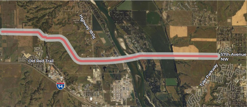
| 65 | Northern Bridge | 38th Street (Mandan) | River Road | Construct as 4-lane rural roadway from River Road (Bismarck) to 38th Street (Mandan), including construction of Missouri River Bridge. | $85,556,500 |
| 66 | 37th Street NW | 56th Avenue | ND 1806 | Construct 3-lane urban section. | $49,700,000 |
| 67 | 37th Street NW | ND 25 | 56th Avenue | Construct 2-lane urban section. | $24,924,000 |
| 68 | ND 1806 | Old Red Trail | 37th Street | Intersection capacity improvement, add turn lanes at key intersections. (Assume minor intersection improve-ments to match new 37th St section). | $6,425,070 |
| 69 | 38th Street NW | Old Red Trail | Collins Avenue / ND 1806 | Construct as 3-lane urban section. | $21,300,000 |
| 70a | 8th Avenue NW | 27th Street NW | 37th Street NW | Construct 3-lane urban section. | $7,100,000 |
| 70b | 8th Avenue NW | 37th Street NW | 38th Street | Construct 3-lane urban section. | $7,100,000 |
| 71a | Sunset Drive | Middle School | 37th Street NW | Construct as 3-lane urban section. | $5,325,000 |
| 71b | Sunset Drive | 37th Street NW | 38th Street | Construct as 3-lane urban section. | $5,325,000 |
| 72a | 37th Street NW | Sunset Drive | ND 1806 | Construct urban 3-lane for arterial connection. | $9,585,000 |
| 72b | 37th Street NW | Old Red Trail | Sunset Drive | Construct urban 3-lane for arterial connection. | $9,585,000 |
| 73 | Division Street NE | Chippewa Avenue NE | Mandan Avenue | Construct as 2-lane urban section. | $6,324,000 |
| 74 | Sunset Drive | Old Red Trail | 31st Street NW | Reconstruct as 3-lane urban section. | $6,532,000 |
| 75 | Sunset Drive Corridor | 27th Street N | Boundary Street | Intersection improvements along Sunset at 27th, Old Red Trail, and Boundary. | $5,925,000 |
| 77 | Old Red Trail | 8th Avenue NW | ND1806 / Collins Avenue | Restripe for 3-lane urban section. | $93,615 |
| 78 | Mandan Avenue | I-94 | Interchange reconstruction. | $59,250,000 | |
| 80 | Division Street | Sunset Drive | ND 1806 / Collins Avenue | Reconstruct as 3-lane urban section. | $6,816,000 |
| 81 | Sunset Drive | Division Street | Boundary Street | Reconstruct as 3-lane urban section. | $7,526,000 |
| 82 | 3rd Avenue NE | 5th Street NE | Division Street NW | Narrow pavement. | $5,925,000 |
| 83 | I-94 | I-194 | Main Street / Exit 155 | Recommendation pending Grant Marsh Bridge Feasibility Study. | $0 |
| 84 | Highway 1806 | 19th Street SW | Heart River Bridge | Pavement preservation project, including addition of turn lanes and signals at 8th Avenue and 19th Street. | $4,147,500 |
| 85 | 19th Street SE | ND 6 | ND1806 | Reconstruct as 3-lane urban section. | $25,560,000 |
| 86 | McKenzie Drive | 46th Avenue SE | Intersection capacity improvement. | $5,925,000 | |
| 87 | McKenzie Drive | ND 1806 | 40th Ave S | Construct as 2-lane rural section. | $25,000,000 |
| 88 | McKenzie Drive | ND 6 | ND 1806 | Construct as 2-lane rural section. | $16,632,000 |
| 89 | 56th Avenue | Old Red Trail | 37th Street | Reconstruct as 3-lane urban section. | $14,200,000 |
| 90 | Old Red Trail | 47th Avenue NW | 57th Avenue NW | Old Red Trail realignment to accommodate future interchange. | $4,884,000 |
| 91 | 56th Avenue NW | I-94 Business Loop (Main Street) | Old Red Trail | Construct as 3-lane urban section. | $34,222,000 |
| 92 | Boundary Road | 56th Avenue / I-94 Interchange | 32nd Avenue NW | Construct as 3-lane urban section. | $22,436,000 |
| 93 | 32nd Avenue W | I-94 Business Loop (Main Street) | Boundary Road (Future) | Construct as 2-lane urban section. | $26,536,000 |
| 94 | Boundary Road | 32nd Avenue | Sunset Drive | Construct as 3-lane urban section. | $23,430,000 |
| 95 | 31st Street NW | Lohstreter Road | Boundary Road (Future) | Construct as 2-lane urban section. | $12,276,000 |
| 96 | Division Street | Sunset Drive | Lohstreter Road | Construct urban 3-lane to extend Division Street. | $13,490,000 |
| 97 | 3rd Street SW | 6th Avenue / ND1806 | Memorial Highway | Restripe / overlay to include turn lanes or restripe to 3-lane section with center turn lane and no parking. | $500,000 |
| 99 | 56th Avenue NW | I-94 | New interchange. | $34,250,000 | |
| 100 | 32nd Avenue | I-94 | Grade separation- overpass / underpass. | $20,550,000 | |
| 101 | 3rd Street SW | 6th Avenue SE | Highway 6 | Restripe / overlay to include turn lanes or restripe to 3-lane section with center turn lane and no parking. | $500,000 |
| 102 | Main Ave | 26th St | Intersection capacity improvement / Roundabout. | $3,000,000 | |
| 103 | 43rd Ave N | 52nd St | Intersection capacity improvement / Roundabout. | $3,000,000 | |
| 104 | Burleigh Ave | 12th St | Intersection capacity improvement / Roundabout. | $3,000,000 | |
| 105 | 27th St | Sunset Dr | Intersection capacity improvement / Roundabout. | $2,250,000 | |
| 106 | 71st Avenue NE | Centennial Road | Intersection capacity improvement / Roundabout. | $5,000,000 |
Some of the alternatives were combined into larger categories of strategies that could address major regional travel needs, and some multimodal strategies like bicycle and pedestrian improvements and transit investments were further considered.
Create a new Missouri River Bridge and continuous corridor between north Mandan and north Bismarck, approximately at 38th Street (Mandan) and 57th Avenue N (Bismarck).
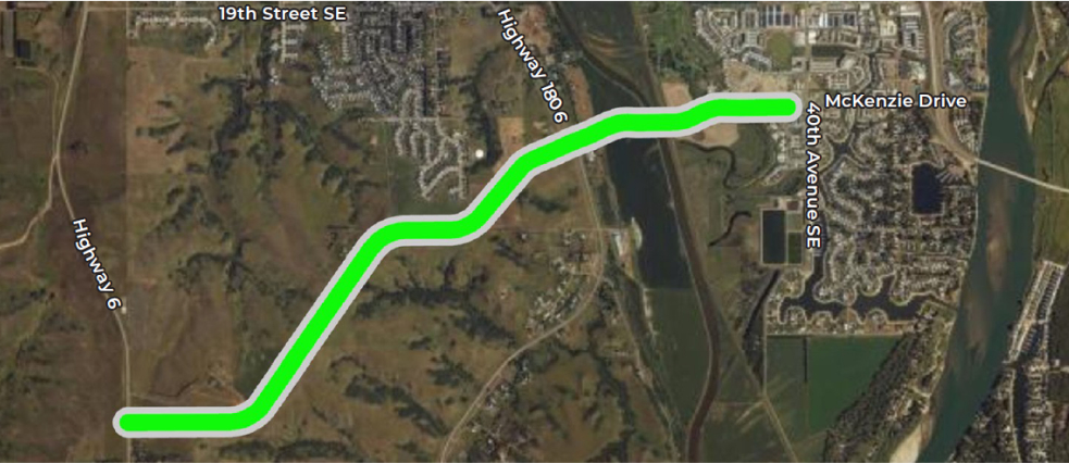
Build a new connection in south Mandan by extending McKenzie Drive between 40th Avenue SE and Highway 6, including a new Heart River Bridge.
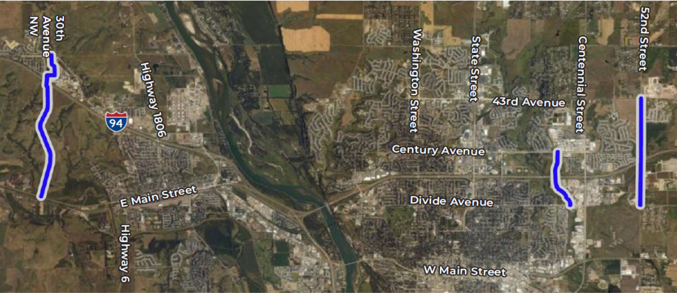
Extend new corridors across Interstate 94 to increase the connections between portions of Bismarck and Mandan divided by I-94. This includes potential crossings at 52nd Street (Bismarck), Hamilton Street (Bismarck), and 30th Street (Mandan).
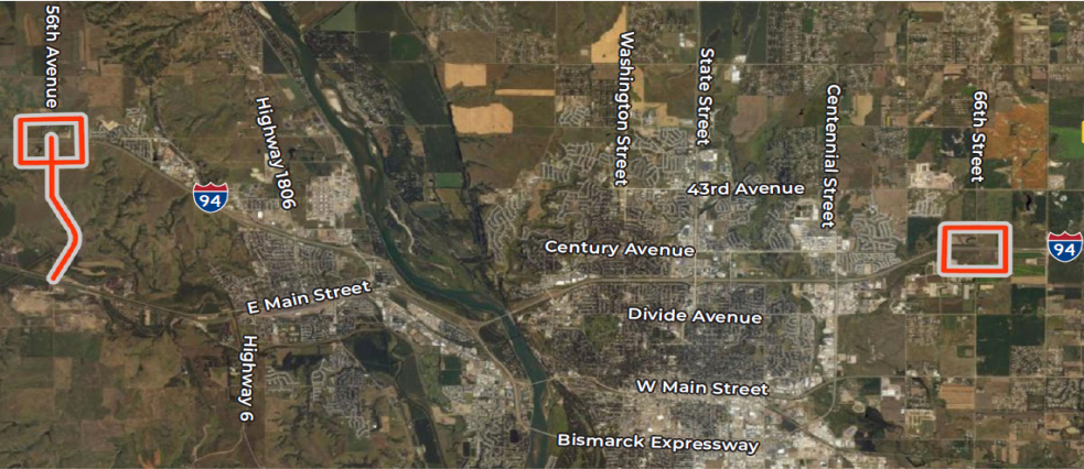
Improve access to Interstate 94 through new interchanges at 56th Avenue (west Mandan) and 66th Street (east Bismarck).
Manage safety and operations on mature street corridors through low-impact improvements like turn lanes, safety upgrades, and intersection control improvements (traffic signal or roundabouts).
Connect Lincoln and NE Bismarck through street improvements along 66th Street between Lincoln Road and 71st Street (including a new Interstate 94 crossing) and improving 71st Avenue N between 66th Street and State Street.
Create a continuous urban grid system in growth areas including north Bismarck corridors such as 26th Street, 57th Avenue east of 19th Street, and 57th Avenue west of Tyler Parkway. In north Mandan, this would include 24th Street and 37th Street west of Highway 1806 and extending Sunset Drive and 12th Avenue NW farther north.
Identify additional funding sources to provide stable fixed route and dial-a-ride public transit service.
| Period | Year | Projected Income | Projected Costs | Funding Cap |
|---|---|---|---|---|
| Base Year | 2023 | $5,552,345 | $6,085,930 | $533,585 |
| Future Projections | 2024 | $5,324,342 | $6,657,008 | $1,332,666 |
| 2025 | $5,918,946 | $7,439,292 | $1,520,346 | |
| 2026 | $5,403,210 | $6,920,651 | $1,517,441 | |
| 2027 | $6,192,728 | $7,943,234 | $1,750,506 | |
| 2028 | $4,752,589 | $6,348,606 | $1,596,017 | |
| 2029 | $5,875,502 | $8,290,1286 | $2,414,626 |
Increase local contributions to transit through property tax mill levy, or increased lump sum contributions.
Reduce expense related to contracting, or reduce service hours and/or routes.
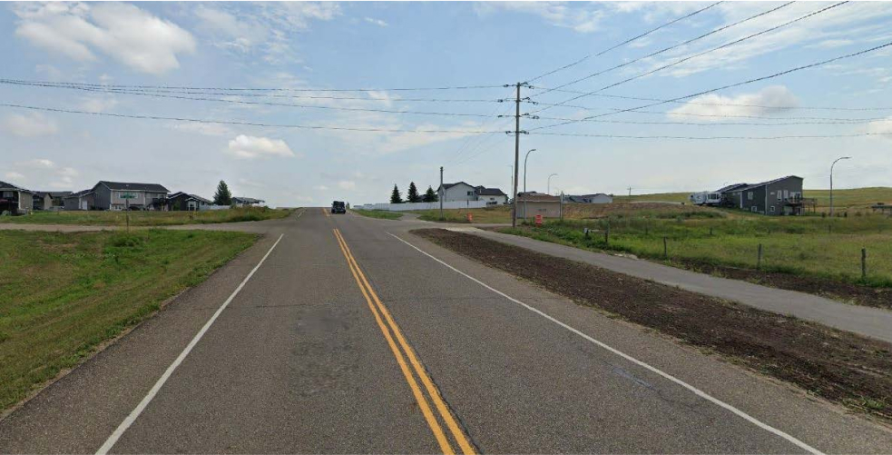
Add more bicycle and pedestrian paths such as side paths along streets and new recreational trails to connect more parts of the metropolitan area.
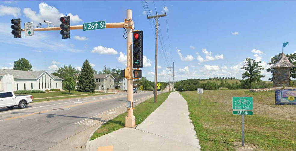
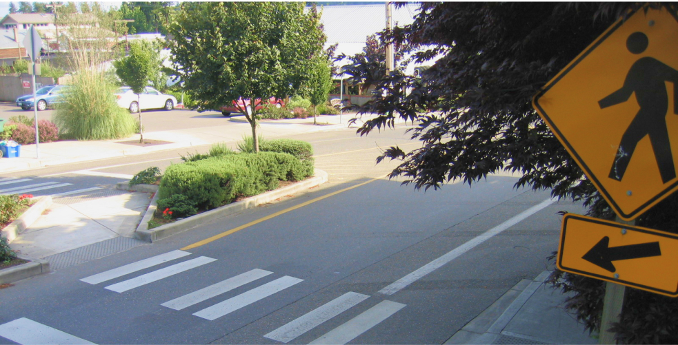
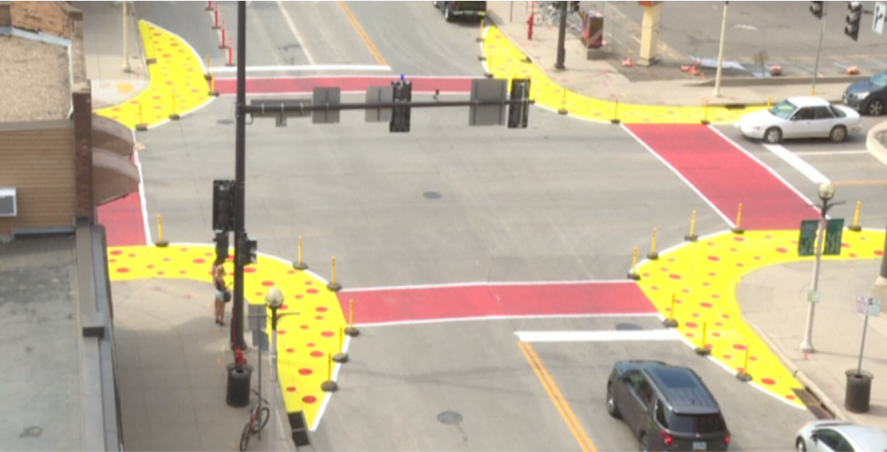
Focus investments on improved pedestrian street crossings, such as high visibility crossings, pedestrian signals, and curb extensions to reduce crossing distance and improve pedestrian visibility.
The draft project list includes those alternatives that were higher priority based on system needs and on funding available through the MPO. Many projects included in the strategies and alternatives lists are important and will be considered for implementation if additional funding becomes available. Those projects are called “illustrative projects” and can be viewed in the Draft Arrive 2050 Report.
Short-term projects are projected to be in 2029 – 2033.
| ID | Program | Corridor Location | From | To | Description | 2024 Cost |
|---|---|---|---|---|---|---|
| 97 | Urban Roads | 3rd Street SW | 6th Avenue / ND1806 | Memorial Highway | Restripe / overlay to include turn lanes or restripe to 3-lane section with center turn lane and no parking. | $500,000 |
| R1 | Urban Roads | Burleigh Ave | Boston Dr | University Dr / ND 1804 | Asphalt Mill and Overlay. | $1,300,000 |
| R12 | Urban Roads | 52nd St | Main Ave | Divide Ave | Asphalt Mill and Overlay. | $1,500,000 |
| R24 | Urban Roads | Riverwood Ave | Memorial Hwy | 3rd St SE | Reconstruction. | $2,400,000 |
| R3 | Urban Roads | 52nd St | Apple Creek Rd | Main Ave | Asphalt Mill and Overlay. | $1,200,000 |
| R27a | Urban Roads | 66th Street SE | Lincoln Road | Northgate Drive | Mill and Overlay. | $2,000,000 |
| R22 | Urban Roads | Calgary Ave | 14th St | East of St Lawrence St (end of ditch section) | Reconstruction. | $2,400,000 |
| 103 | Urban Roads | 43rd Ave N | 52nd St | Intersection capacity improvement / Roundabout. | $3,000,000 | |
| R17 | Urban Roads | Main Ave | Memorial Hwy | Washington St | Concrete Pavement Repair. | $2,000,000 |
| R11 | Urban Roads | 52nd St | Gold Dr | 43rd Ave N | Asphalt Mill and Overlay. | $500,000 |
| R20 | Urban Roads | Main Ave | 12th St | Airport Rd | Concrete Pavement Repair. | $1,100,000 |
| R4 | Urban Roads | 57th Ave N | Tyler Pkwy | Washington St | Asphalt Mill and Overlay. | $1,200,000 |
| R27b | Urban Roads | 66th Street SE | Apple Creek Road | E Main Avenue/County Road 10 | Mill and Overlay. | $2,000,000 |
| R21 | Urban Roads | Main Ave | Airport Rd | 26th St | Concrete Pavement Repair. | $1,100,000 |
| R23 | Urban Roads | Sunset Drive | Division Street | Grade Raise. | $1,500,000 | |
| R9 | Urban Roads | US 83 East Frontage Rd (Ridgedale St) | Elbowoods Ln | 64th Ave N | Asphalt Mill and Overlay. | $900,000 |
| R15 | Urban Roads | Washington St | 48th Ave S | Burleigh Ave | Asphalt Mill and Overlay. | $1,200,000 |
| R6 | Urban Roads | Tyler Pkwy | Cogburn Rd | 57th Ave N | Asphalt Mill and Overlay. | $1,500,000 |
| 101 | Urban Roads | 3rd Street SW | 6th Avenue SE | Highway 6 | Restripe / overlay to include turn lanes or restripe to 3-lane section with center turn lane and no parking. | $500,000 |
| R7 | Urban Roads | Tyler Pkwy / 15th St NW | 57th Ave N | ND 1804 | Asphalt Mill and Overlay. | $1,200,000 |
| 11 | Highway Safety | Lincoln Road | Yegen Road / Airway Avenue | Intersection capacity improvement. | $3,000,000 | |
| 105 | Highway Safety | Sunset Drive | 27th Street NW | Roundabout. | $2,250,000 | |
| 13 | Transportation Alternatives | 6th Avenue SE | 3rd Street SE | 1st Street NE | Shared use path. | $152,000 |
| 14 | Transportation Alternatives | 3rd Street SW & SE | Highway 6 | 6th Avenue SE | Buffered bike lanes. | $65,000 |
| 24 | Transportation Alternatives | 3rd Street SE | 6th Avenue SE | Improved signaling; curb extensions, centerline hardening, or modern roundabout. | $134,000 | |
| 28 | Transportation Alternatives | ND 1806 | Old Red Trail | 38th Street | Mill/overlay. | $700,000 |
| 29 | Transportation Alternatives | 19th Street SE | ND 1806 | 14th Avenue SE | Mill/overlay. | $300,000 |
| 30 | Transportation Alternatives | Old Red Trail | 43rd Avenue NW | Construct shared use path. | $300,000 | |
| 31 | Transportation Alternatives | Cottonwood Park Trail | Burleigh Avenue | Asphalt overlay. | $90,000 | |
| 32 | Transportation Alternatives | Burleigh Avenue Trail | Washington Street | Overlay with patching. | $190,000 |
Mid-term projects are projected to be completed in 2034 – 2042.
| ID | Program | Corridor Location | From | To | Description | 2024 Cost |
|---|---|---|---|---|---|---|
| 71a | Urban Roads | Sunset Drive | Middle School | 37th Street NW | Construct as 3-lane urban section. | $5,325,000 |
| 25a | Urban Roads | Main Avenue | Bismarck Expressway | 52nd Street | Widen from 2-lane to 3-lane section (including intersection improvement at 52nd Street). | $15,400,000 |
| 17 | Urban Roads | 52nd Street NE | 43rd Avenue NE | E Century Avenue | Widen from 2-lane to 3-lane section / build new 3-lane section. | $15,836,000 |
| 70a | Urban Roads | 8th Avenue NW | 27th Street NW | 37th Street NW | Construct 3-lane urban section. | $7,100,000 |
| 82 | Highway Safety | 3rd Avenue NE | 5th Street NE | Division Street NW | Narrow pavement. | $5,925,000 |
| 102 | Highway Safety | Main Avenue | 26th Street | Intersection capacity improvement / Roundabout. | $3,000,000 | |
| - | Transportation Alternatives | Additional Trail Maintenance Projects. | Cost TBD | |||
| 1a | Transportation Alternatives | S Washington Street | W Wachter Avenue | W Reno Avenue | Shared use path. | $172,000 |
| 1b | Transportation Alternatives | S Washington Street | W Reno Avenue | Bismarck Expressway | Shared use path. | $131,000 |
| 1c | Transportation Alternatives | S Washington Street | Bismarck Expressway | W Main Avenue | Shared use path. | $299,000 |
| 11 | Transportation Alternatives | E Bismarck Expressway | S 26th Street | E Rosser Avenue | Shared use path. | $726,000 |
| 12 | Transportation Alternatives | E Main Avenue | S 26th Street | E Bismarck Expressway | Shared use path. | $443,000 |
| 15 | Transportation Alternatives | Sunset Drive NW | 8th Street NW | Boundary Street NW | Buffered or separated bike lanes. | $40,000 |
| 16 | Transportation Alternatives | 6th Ave NW | 1st Street NW | 8th Street NW | Buffered or separated bike lanes. | $29,000 |
| 25 | Transportation Alternatives | Sunset Drive NW | Old Red Trail NW | ADA upgrades, widened ramps to accommodate trail crossing on south and east approaches, crosswalk striping, extend sidewalk and crossing on west and north approaches, improved signals, centerline hardening. | $35,000 | |
| 26 | Transportation Alternatives | 1st Street NW | Collins Avenue | White edge lines on crosswalks, option for mini roundabout . | $10,000 | |
| 36 | Transportation Alternatives | Southland -Marietta segment | Marietta Dr (N) | Marietta Dr (SE) | Overlay. | $50,000 |
| 37 | Transportation Alternatives | Bank of ND Trail | Memorial Hwy | Bell St | Remove and replace trail. | $230,000 |
Long-term projects are projected to be completed in 2043 – 2050.
| ID | Program | Corridor Location | From | To | Description | 2024 Cost |
|---|---|---|---|---|---|---|
| 72a | Urban Roads | 37th Street NW | Sunset Drive | ND 1806 | Construct urban 3-lane for arterial connection. | $9,585,000 |
| 7 | Urban Roads | 66th Street | Apple Creek | Old Highway 10/ E Main Avenue | Widen from 2-lane to 3-section. | $14,948,000 |
| 25b | Urban Roads | Main Avenue | 52nd Street | 66th Street | Widen from 2-lane to 3-lane section. | $15,400,000 |
| 104 | Highway Safety | Burleigh Avenue | Boston Drive | Intersection capacity improvement / Roundabout. | $3,000,000 | |
| - | Transportation Alternatives | Additional Trail Maintenance Projects. | Cost TBD | |||
| 2 | Transportation Alternatives | N 4th Street | W Main Avenue | E Boulevard Avenue | Shared lane markings or advisory bike lanes, possible traffic calming. | $14,000 |
| 3a | Transportation Alternatives | N 4th Street | E Boulevard Avenue | Ridgecrest Drive | Buffered bike lanes. | $107,000 |
| 3b | Transportation Alternatives | Dominion Street | Ridgecrest | N 10th Street | Buffered bike lanes. | $9,000 |
| 4 | Transportation Alternatives | N 12th Street | East Broadway Avenue | Avenue C | Shared lane markings or advisory bike lanes, possible traffic calming. | $6,000 |
| 5b | Transportation Alternatives | S 12th Street | University Drive | Bismarck Expressway | Buffered or separated bike lanes. | $43,000 |
| 5c | Transportation Alternatives | S 12th Street | E Bismarck Expressway | E Broadway Avenue | Buffered bike lanes. | $45,000 |
| 6 | Transportation Alternatives | W & E Main Avenue | N Washington Street | N 26th Street | Buffered or separated bike lanes. | $112,000 |
| 7 | Transportation Alternatives | W & E Bowen Avenue | S Washington Street | S 5th Street | Buffered or separated bike lanes. | $26,000 |
| 8 | Transportation Alternatives | S 5th Street | E Bowen Avenue | E Main Street | Shared lane markings, standard or buffered bike lane. | $13,000 |
| 9 | Transportation Alternatives | N 6th Street | E Main Avenue | E Boulevard Avenue | Shared lane markings or advisory bike lanes, possible traffic calming. | $14,000 |
| 17 | Transportation Alternatives | 8th Avenue NW | W Main Street | 9th Street NW | Shared lane markings or advisory bike lanes (The segment between 2nd Street NW and 4th Street NW may use 7th Avenue NW rather than the 8th Avenue NW unimproved right-of-way.) | $12,000 |
| 20 | Transportation Alternatives | Tyler Parkway | I-94 Ramp & W Divide Avenue & Schafer Street | Enlarged pedestrian refuges, removal of channelized right turn lanes (or Smart Channel Design), tighter turning radii. | $120,000 | |
| 23 | Transportation Alternatives | State Street | E Boulevard Avenue | Improve crossing east of intersection with marked crosswalk, widened ramps, and ADA upgrades. | $40,000 | |
| 27 | Transportation Alternatives | E Main Street | 3rd Avenue NE | Pedestrian Hybrid Beacon, pedestrian refuge, marked crosswalk. | $720,000 | |
| 38 | Transportation Alternatives | Clairmont Road | Promontory Place | Burnt Boat Drive | Shared use path. | $160,000 |
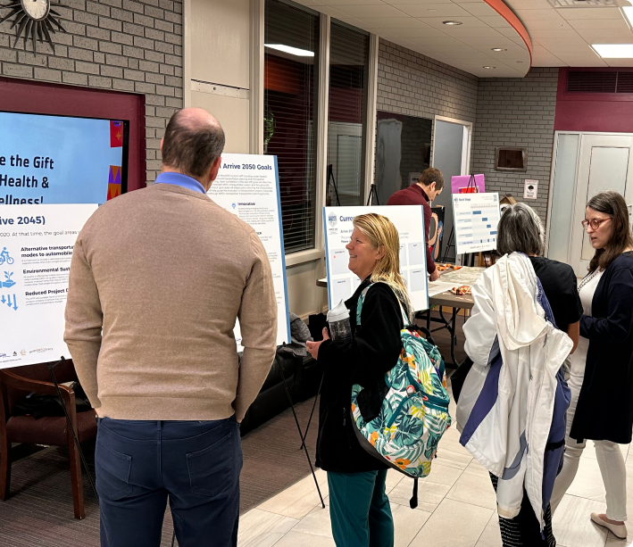
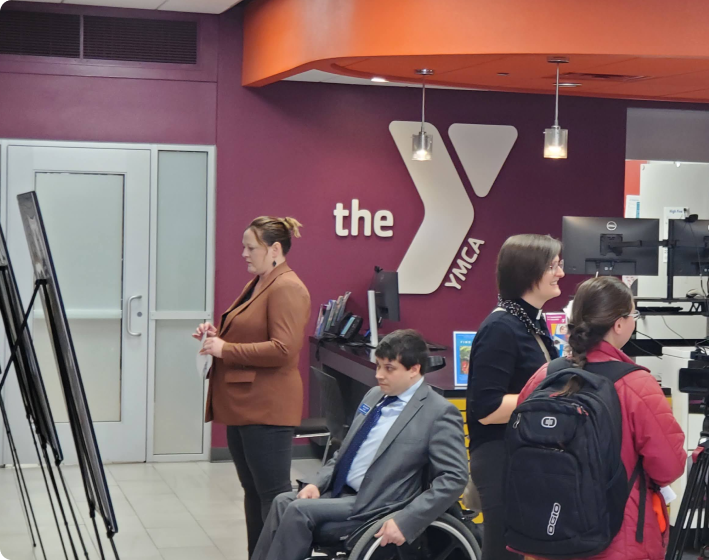
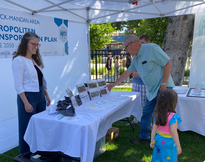
This is the final input opportunity for Arrive 2050. The Bismarck-Mandan Area MPO is finalizing the Metropolitan Transportation Plan. Once the plan has been approved by the MPO’s partners, it will be posted on the project website.


Please provide your feedback on the Bismarck-Mandan Arrive 2050 Metropolitan Transportation Plan.
To provide feedback on specific locations within the area, head over to the comment map on the project website.
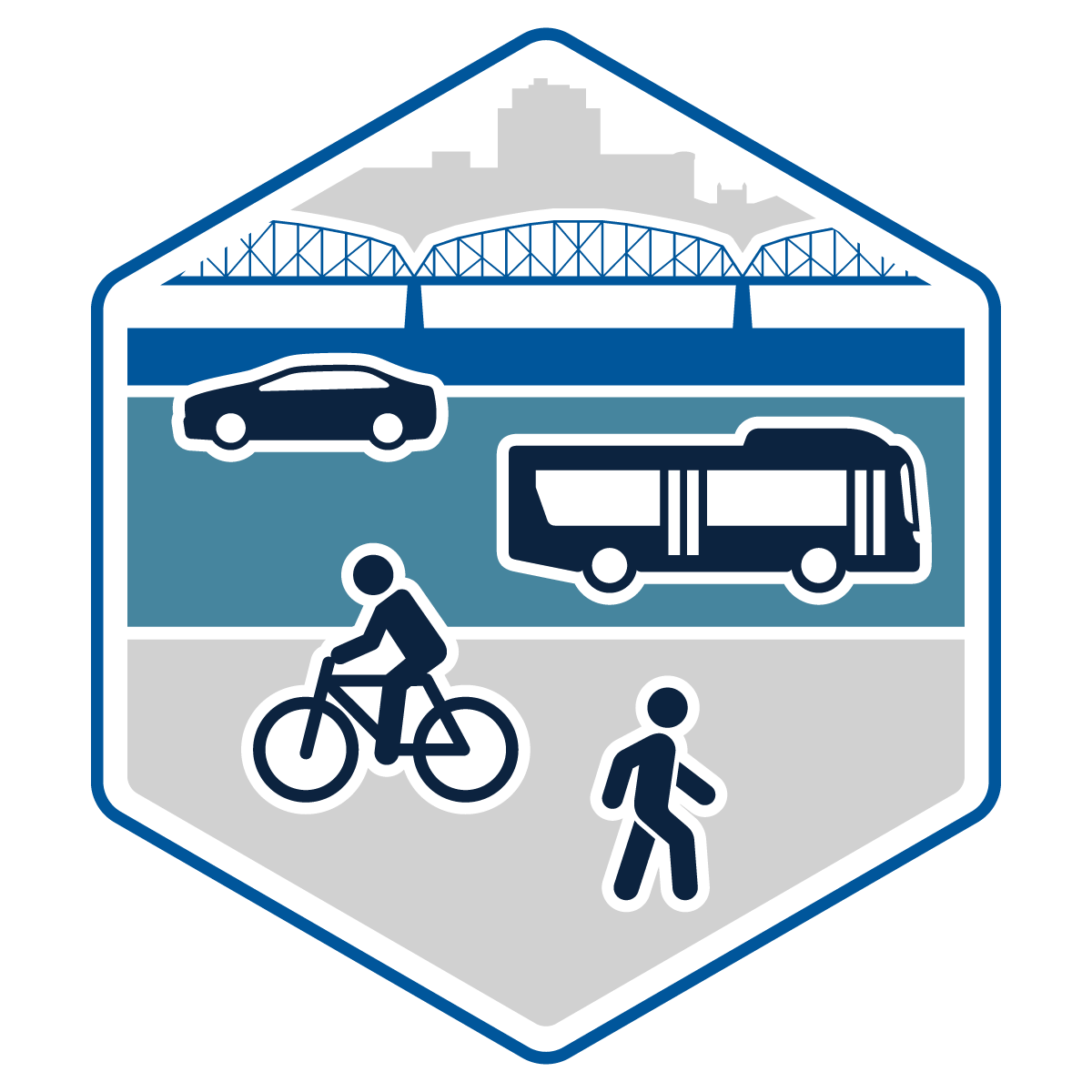
The Bismarck-Mandan Area MPO and its partners have prepared a draft Metropolitan Transportation Plan (MTP) for public review. The MTP analyzes current transportation conditions, establishes a vision for the future of transportation, forecasts future scenarios, and provides recommendations to shape the future of transportation in the Bismarck-Mandan area.